Cross borders, experience nature, feel history: the Grenzenlos hiking trail connects Bavaria and Tyrol in five varied stages. From Bad Endorf via Lake Chiemsee, through idyllic villages and mountain valleys to Kufstein, it leads through a landscape full of contrasts and shared culture. Sometimes Bavarian, sometimes Tyrolean – always crossing borders.
The Grenzenlos Hiking Trail leads in five stages from Bad Endorf, Rimsting, Prien am Chiemsee, Frasdorf, Aschau im Chiemgau, and Sachrang across the Austrian border to Erl – returning to Bavaria via the Zollhaus Bridge near Oberaudorf and continuing on to Kiefersfelden. At Lake Hechtsee, the trail once again crosses into Tyrol and ends in Kufstein.
Stage 1: Bad Endorf – Prien am Chiemsee15.4 km – approx. 3:50 h – 95 m ascent – 99 m descent
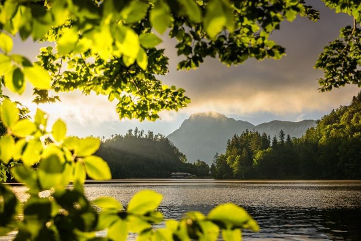
From the Chiemgau Thermal Spa in Bad Endorf, the trail leads past the Curate Church of St. Rupert & St. Laurentius to Hemhof. A good place to stop for refreshments is the Kramerwirt – better known as “Hubbi” or “Brandlwirt.” The route then continues through woodland towards Rimsting. At Schafwaschen, we reach the shores of Lake Chiemsee and enjoy stunning views over the “Bavarian Sea.” At the Rimsting lido, the River Prien flows into the lake – a river that will accompany us throughout the next stages. Following the shoreline and passing small settlements, we finally arrive in Prien am Chiemsee, the destination of the first stage.
Stage 2: Prien am Chiemsee – Aschau im Chiemgau14.2 km – approx. 3:45 h – 205 m ascent – 121 m descent
From Prien’s marketplace, the trail leads into the romantic Eichental Valley, past a historic power station and through quiet woodlands. Passing small hamlets, we reach Wildenwart, where a castle towers on a hilltop – and the adjacent Schlosswirtschaft inn invites you to take a break. With the Chiemgau Alps ahead, the path continues alongside the Prien River. On the river embankment, the striking Kampenwand mountain with its jagged peaks greets us. Finally, we arrive in Aschau im Chiemgau, recognizable by its double-towered church and the wide view over the Prien Valley. For those who wish, the Chiemgau Railway offers request stops along the way to shorten the hike.
Stage 3: Aschau im Chiemgau – Sachrang13.5 km – approx. 3:35 h – 161 m ascent – 32 m descent
Starting in the center of Aschau, the route passes Hohenaschau Castle, while above, the colorful gondolas of the Kampenwand cable car float skyward. Always following the River Prien, the path winds through idyllic woodland. Worthwhile detours include the small Kettenkapelle chapel at Hammerbach or the impressive Schoßrinn Waterfall. In the Prien Valley, a section of the trail follows the themed “Forest Pharmacy” path, where information boards explain the healing powers of plants and trees. Eventually, we reach the mountaineering village of Sachrang with its parish church of St. Michael – the destination of this stage.
Stage 4: Sachrang – Oberaudorf16 km – approx. 4:25 h – 320 m ascent – 578 m descent
From the mountaineering village of Sachrang, the trail climbs via Schweibern to Reichenau, where we cross the border into Austria. With sweeping views of the Prien Valley and the Kaiser Mountains, the route continues – and cozy inns such as the Moosbauer mountain inn invite hikers to rest. From the ridge path, the Inn Valley comes into sight, with the Wendelstein mountain and our destination Oberaudorf already visible. Passing Anzing and Schönau, the trail descends to the Zollhaus Bridge, which connects Bavaria and Tyrol. After crossing the mighty River Inn, we follow the scenic Auerbach stream to Bad Trißl and continue through forests and along forest roads to the Hocheck adventure mountain and into the center of Oberaudorf.
Stage 5: Oberaudorf – Kufstein12.6 km – approx. 3:40 h – 273 m ascent – 266 m descent
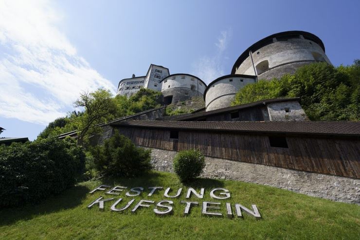
From Oberaudorf, the trail leads to Lake Luegstein and, for the adventurous, further to the Grafenloch cave with its spectacular panoramic views. Continuing through the district of Mühlbach, we reach Kiefersfelden, before the path meanders quietly through forests and meadows to the Kieferbach River. Shady and refreshing, the river accompanies us to Lake Hechtsee on the Tyrolean side – an ideal place for swimming or resting. The route then continues past Lake Längssee and Lake Pfrillsee before descending to Kufstein. Ahead lies the imposing fortress above the old town – a fitting conclusion to the Grenzenlos Hiking Trail.


