Callback

We're happy to call you!

Go to the tours.
All routes, all info.

Searchfor room

orNon-binding enquiry
Filter


KOASA-33s hike

KOASA-33s hike

On the classic hike explore the southern side of the Zahmer Kaiser and the Kaisertal over 33 kilometers.

  • Type: Hiking
  • Start: Secondary school Ebbs
  • End: Secondary school Ebbs
  • Difficult
  • 12:00 h
  • 1910 m
  • 33.0 km
Watch listDetails


EUREGIO-Marien-Weg-M3

EUREGIO-Marien-Weg-M3

On this 84 kilometer long pilgrimage you explore the entire region of Kufsteinerland. In the foreground are various Marian monuments that invite you to linger and come to rest. The stage length can be chosen according to your physical condition.

  • Type: Hiking
  • Start: Kufstein Marienbrunnen
  • End: Kufstein Marienbrunnen
  • Easy
  • 52:16 h
  • 3190 m
  • 179.0 km
Watch listDetails


EUREGIO-Marien-Weg-M2 - Tour overview

EUREGIO-Marien-Weg-M2 - Tour overview

On this 308 kilometer long pilgrimage you explore the entire region of Kufsteinerland. In the foreground are various places of pilgrimage or pilgrimage churches which invite you to stay and explore. The stage length can be chosen according to your physical condition.

  • Type: Hiking
  • Start: Kufstein Marienbrunnen
  • End: Kufstein Marienbrunnen
  • Easy
  • 89 h
  • 7209 m
  • 308.2 km
Watch listDetails


EUREGIO-Maria-Weg-M4

EUREGIO-Maria-Weg-M4

On this 123-kilometre long pilgrimage, you explore the entire region of Kufsteinerland. The focus is on various Marian monuments that invite you to linger and find peace. The length of the stages can be chosen according to your physical condition.

  • Type: Hiking
  • Start: Kufstein Marienbrunnen
  • End: Kufstein Marienbrunnen
  • Easy
  • 36 h
  • 2330 m
  • 123.0 km
Watch listDetails


EUREGIO Marien-Weg-M6

EUREGIO Marien-Weg-M6

Auf dieser 12 Kilometer langen Pilger-Weitwanderung erkundet man die ganze Region des Kufsteinerlandes. Im Vordergrund stehen diverse Marien Denkmäler die zum Verweilen und zur Ruhe kommen einladen. Die Etappenlänge kann je nach Kondition selbst gewählt werden.

  • Type: Hiking
  • Start: Kufstein Marienbrunnen
  • End: Kufstein Marienbrunnen
  • Easy
  • 3:38 h
  • 268 m
  • 12.1 km
Watch listDetails


EUREGIO-Maria-Weg-M5

EUREGIO-Maria-Weg-M5

On this 167-kilometre long pilgrimage, you explore the entire region of the Kufsteinerland, as well as the neighbouring Bavarian Pre-Alps. You roam through the northern branches of the Chiemgau Alps, reach the Bavarian Sea - the Chiemsee - walk through the picturesque Rosenheim and hike along the foothills of the Wendelstein back to Kufstein. In the foreground are various Marian monuments that invite you to linger and come to rest. The length of the stage can be chosen according to your physical condition.

  • Type: Hiking
  • Start: Marienbrunnen Kufstein
  • End: Kufstein Marienbrunnen
  • Easy
  • 46:15 h
  • 2971 m
  • 166.6 km
Watch listDetails


Across the meadow slopes of the Semmelkopf

Across the meadow slopes of the Semmelkopf

Very flowing tour over meadows and through small forests on the ridge between Semmelkopf and Saurüssel and the Kaisergebirgsblick as a highlight.

  • Type: Running
  • Start: Landl church
  • End: Landl church
  • Medium
  • 2:45 h
  • 900 m
  • 12.4 km
Watch listDetails


Cave Stone Circuit

Cave Stone Circuit

Steep, but worthwhile round to the Höhlensteinhaus with the small summit experience on the Feuerköpfl. A breathtaking view and excellent gray cheese reward the efforts uphill.

  • Type: Hiking
  • Start: Hiking parking lot Windschnur
  • End: Hiking parking lot Windschnur
  • Medium
  • 4:30 h
  • 757 m
  • 8.4 km
Watch listDetails


Ursprungweg

Ursprungweg

Return to the origins. Enjoy the forest, the water, the meadows and immerse yourself in the common history. The Ursprungweg, which is just under 52 kilometers long, leads from the Bavarian Wörnsmühl near Fischbachau via Bayrischzell and the Ursprungpass to the Tyrolean Riedenberg and on to Thiersee.

  • Type: Hiking
  • Start: Drachenthal hiking car park, Wörnsmühl
  • End: Thiersee
  • Medium
  • 14:48 h
  • 2149 m
  • 51.8 km
Watch listDetails


Homecoming Cross and Schönfeldjoch Circuit

Homecoming Cross and Schönfeldjoch Circuit

An absolute dream tour, with very high trail share and gigantic views.

  • Type: Running
  • Start: Hiker parking lot at the pass of origin
  • End: Hiker parking lot at the pass of origin
  • Medium
  • 1083 m
  • 13.0 km
Watch listDetails


Köglhörndl and Feuerköpfll

Köglhörndl and Feuerköpfll

On this varied tour you climb two panoramic peaks above the Inn valley: Köglhörndl and Feuerköpfl.

  • Type: Running
  • Start: Hinterthiersee church
  • End: Hinterthiersee church
  • Medium
  • 843 m
  • 13.7 km
Watch listDetails


Ursprung Round

Ursprung Round

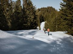
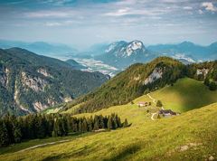
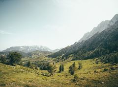
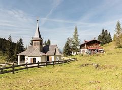
Connection of the Bayrischzell cross-country skiing network to Tyrol.

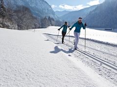
  • Type: Cross-country skiing, classic cross-country skiing, cross-country skating Ski-nordic-classic Ski-nordic-skating
  • Start: Parking lot Mariandlalm
  • End: Parking lot Mariandlalm
  • Difficult
  • 70 m
  • 5.9 km
Watch listDetails


To the Altkaser Alm via Goglalm

To the Altkaser Alm via Goglalm

Easy and sunny snowshoe round hike over fantastic alpine pasture terrain to the beautifully situated Altkaser Alm at the foot of the Spitzstein.

  • Type: Hiking
  • Start: Car park Erlerbeg
  • End: Car park Erlerbeg
  • Easy
  • 2:15 h
  • 329 m
  • 5.5 km
Watch listDetails

315Tours

Please wait

Information loading...