Covering around 50 kilometres, this long-distance pilgrimage trail combines the impressive Tyrolean mountain scenery with tranquillity, nature and special places of spiritual energy along the way. The stages can be chosen flexibly.
Day 01: Kufstein Marienbrunnen – Thierbergkapelle2.9 km, 216 m elevation gain, approx. 1 hour
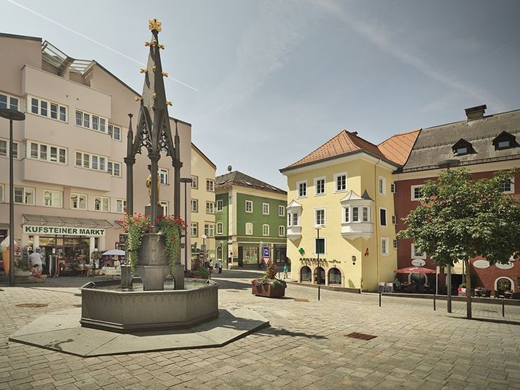
The Marienweg M7 starts at the Marienbrunnen fountain on Unterer Stadtplatz in Kufstein and leads along the Inn promenade and up the Thierbergweg to the pilgrimage chapel on Thierberg hill. Passing the Gschwendt chapel and the Neuhaus inn, a Way of the Cross leads to the destination.
Day 02: Thierberg – Langkampfen Parish Church9.8 km, 102 m elevation gain, approx. 3 hours
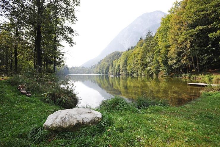
From the pilgrimage chapel on Thierberg, the route continues past Lake Längsee and Lake Pfrillsee towards Langkampfen and the parish church of St. Ursula. Passing Edschlössl manor and following the forest edge above Lake Stimmersee, the trail alternates between natural paths and village areas.
Day 03: Unterlangkampfen/Langkampfen Parish Church – Niederbreitenbach – Pilgrimage Site Mariastein5.8 km, 204 m elevation gain, approx. 2 hours
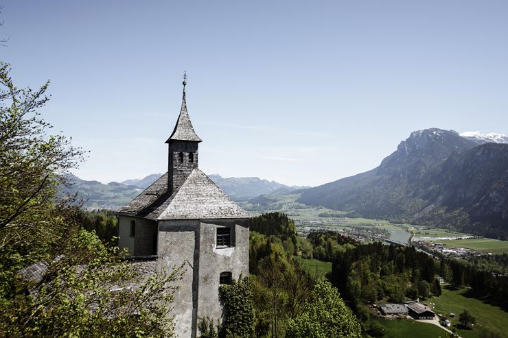
From Unterlangkampfen/Langkampfen parish church, the route continues via Niederbreitenbach towards the pilgrimage site of Mariastein. Passing the Notburga chapel and the Mariasteinerhof inn, the trail follows forest paths and roads to the pilgrimage chapel.
Day 04: Mariastein – Oberlangkampfen 2.4 km, 60 m elevation gain, approx. 20 minutes
From Mariastein, the route continues towards Oberlangkampfen and its church. Passing the Mariasteinerhof inn and following a Way of the Cross, the trail crosses the motorway and follows the Inn River to the destination.Day 05: Oberlangkampfen – Kirchbichl – Bad Häring7.1 km, 165 m elevation gain, approx. 2 hours
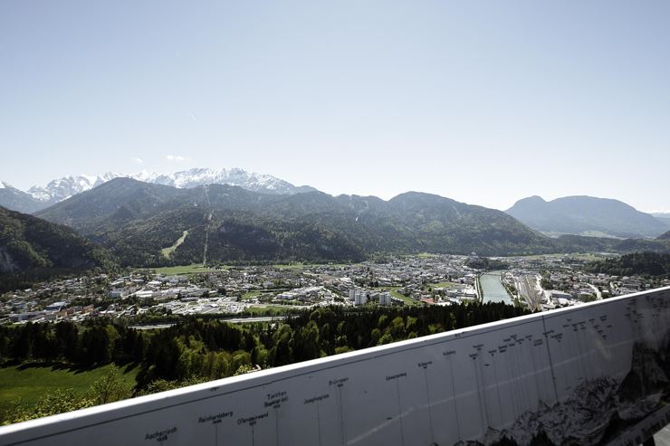
Starting at the church in Oberlangkampfen, the route follows the Inn River via Kirchbichl towards Bad Häring. Passing railway underpasses, panoramic trails and forest edges, the path leads into the village centre to the parish church of St. John the Baptist.
Day 07: Söll – Locherer Chapel – Maria Hilf - Kleinholz – Kufstein Marienbrunnen14 km, 472 m elevation gain, approx. 5 hours
From the parish church in Söll, the route continues via the Locherer Chapel and the Maria Hilf pilgrimage monastery to the Marienbrunnen fountain on Unterer Stadtplatz in Kufstein. The trail leads through forests and meadows, across several streams and through villages, passing the Zellerberg ridge before reaching the destination.No luggage transfer is offered in Kufsteinerland for this long-distance hiking trail.
Day 01: Kufstein Marienbrunnen – Thierbergkapelle2.9 km, 216 m elevation gain, approx. 1 hour
The Marienweg M7 starts at the Marienbrunnen fountain on Unterer Stadtplatz in Kufstein and leads along the Inn promenade and up the Thierbergweg to the pilgrimage chapel on Thierberg hill. Passing the Gschwendt chapel and the Neuhaus inn, a Way of the Cross leads to the destination.
Day 02: Thierberg – Langkampfen Parish Church9.8 km, 102 m elevation gain, approx. 3 hours
From the pilgrimage chapel on Thierberg, the route continues past Lake Längsee and Lake Pfrillsee towards Langkampfen and the parish church of St. Ursula. Passing Edschlössl manor and following the forest edge above Lake Stimmersee, the trail alternates between natural paths and village areas.
Day 03: Unterlangkampfen/Langkampfen Parish Church – Niederbreitenbach – Pilgrimage Site Mariastein5.8 km, 204 m elevation gain, approx. 2 hours
From Unterlangkampfen/Langkampfen parish church, the route continues via Niederbreitenbach towards the pilgrimage site of Mariastein. Passing the Notburga chapel and the Mariasteinerhof inn, the trail follows forest paths and roads to the pilgrimage chapel.
Day 04: Mariastein – Oberlangkampfen 2.4 km, 60 m elevation gain, approx. 20 minutes
From Mariastein, the route continues towards Oberlangkampfen and its church. Passing the Mariasteinerhof inn and following a Way of the Cross, the trail crosses the motorway and follows the Inn River to the destination.Day 05: Oberlangkampfen – Kirchbichl – Bad Häring7.1 km, 165 m elevation gain, approx. 2 hours
Starting at the church in Oberlangkampfen, the route follows the Inn River via Kirchbichl towards Bad Häring. Passing railway underpasses, panoramic trails and forest edges, the path leads into the village centre to the parish church of St. John the Baptist.
Day 07: Söll – Locherer Chapel – Maria Hilf - Kleinholz – Kufstein Marienbrunnen14 km, 472 m elevation gain, approx. 5 hours
From the parish church in Söll, the route continues via the Locherer Chapel and the Maria Hilf pilgrimage monastery to the Marienbrunnen fountain on Unterer Stadtplatz in Kufstein. The trail leads through forests and meadows, across several streams and through villages, passing the Zellerberg ridge before reaching the destination.No luggage transfer is offered in Kufsteinerland for this long-distance hiking trail.